“Trails unite people, trails unite communities.”
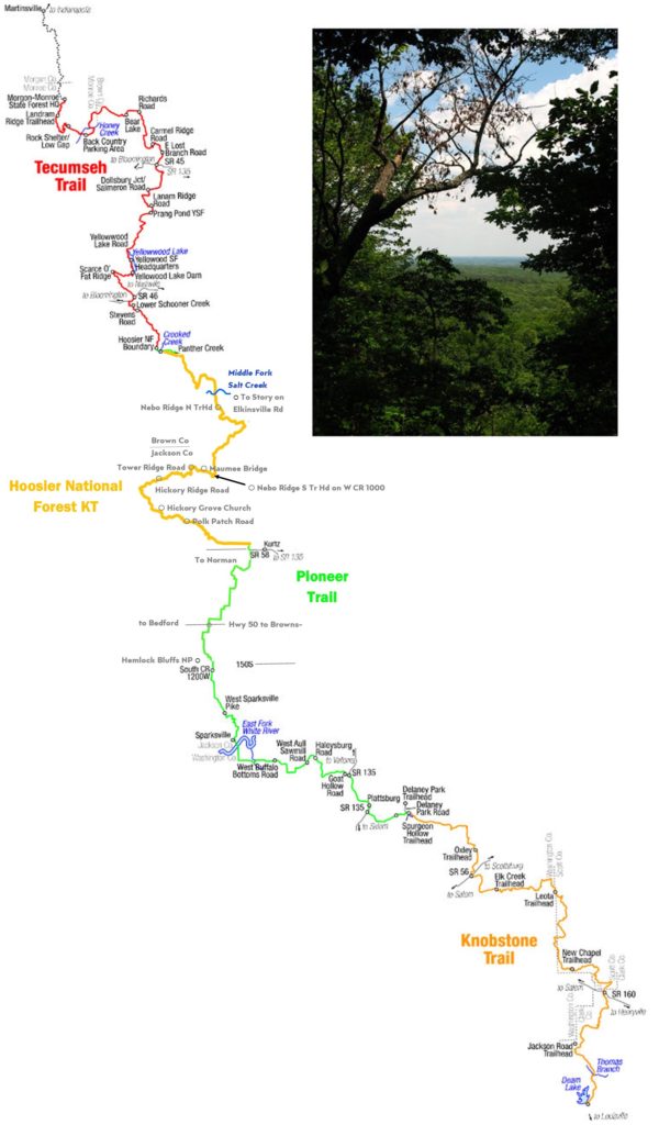
Why hike the KHT? For its indescribable scenery! It takes you 160 miles along an ancient Borden bedrock escarpment. High knobby bluffs of the forested Norman Uplands were separated over millions of years by erosion from the Scottsburg Lowlands. Scenic knobs jut 500 feet above the lowland plains, vestiges of the North American continent’s vast Silurian inland sea. The trail largely follows this scenic escarpment. Views extend as far as the eye can see to the East.
Trailheads connect to within 30 miles of Indianapolis and 20 miles of Louisville. Festivals, historic and cultural offerings provide attractions near the trail for visitors from a distance.
The trail is narrow and rugged; great changes in elevation make it a real challenge. It climbs deep into valleys cut into the escarpment by creeks and rivers over millions of years. Folks often refer to the KHT as a “little AT,” as it is plenty steep and winding, suitable preparation for doing miles on the Appalachian Trail.
Ownership of much of this is public—abandoned forests and farms were acquired by state and federal forest agencies as a Depression legacy. Now magnificent gifts of easements are being donated by private landowners to complete the trail on sections in between public acres.
Forest scenery is diverse; in the fall, vibrant fall foliage and the mists of blue ridges attract visitors from miles around. In the spring, valleys are rich with wildflowers, especially fleeting twinleaf and hepatica, and the truly outstanding redbud and dogwood trees. And then the morels….
Trail Sections
Trail Information
Click here for an interactive map with gpx/kml downloads and many different formats.
Click the below map for section trail conditions, features and trail heads.