The Pioneer Trail Goes Through Jackson and Washington Counties For 37.9 Miles
PRIVATE LAND EASEMENT SECTION, JACKSON CO. 18.7 Miles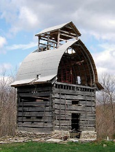
- From the HNF Trailhead for MUT 16 & 17 it is a 1.8 mile road walk crossing Route 58 to the ATV Trailhead on NCR 1000 W. From here you have 3.7 miles of trail on private easement. In route you pass the Frank Fisher’s restore pioneer barn. At the southern end of the private easement you have the HHC Trailhead with a good campsite under pine trees. In this section the nearby town of Norman has a US Post Office where one could resupply.
- The next section is 7.7 miles of road walking, crossing Route 50 to the outstanding Hemlock Bluff Nature Preserve. The trail in the preserve is well worth a side trip. The route South of HWY 50 is a pleasant road walk of hilly country lanes, part gravel, with a sometime challenging crossing of not-always-dry “Dry Creek”
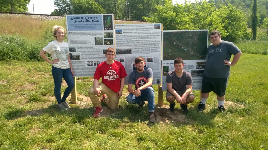
- Another 5.5 mile road walk takes you to Jackson County’s Sparksville Trailside Park, with covered picnic pavilions, CAMPING AREA with woodlands trail and pond board walk, brand-new KHTA-volunteer-built privy (photo of crew), and clean pump water. [This section includes 3.5 miles of easement trail under construction with great views of the White River Valley.]
PRIVATE LAND EASEMENT & STATE FOREST, WASHINGTON CO. 19.2 Miles
- From Sparksville Park it is a 7.9 mile road walk to the
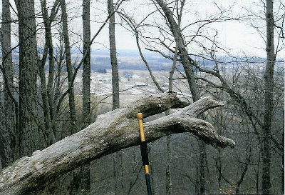 Oak Heritage Conservancy Trailhead. Here there is 1.3 miles of trail taking you up on the Hikers Knob Preserve. Chestnut oaks shade the great view from the summit. Camping is permitted here.
 - Upon reaching Haleysburg Road you soon pass on the left a granite stone marker honoring the donors in Washington County who made this trail section possible. Above the monument is state land through which we hope some day to construct trail over to Hwy 135. Until then we have a 4.5 mile road walk to the highway.
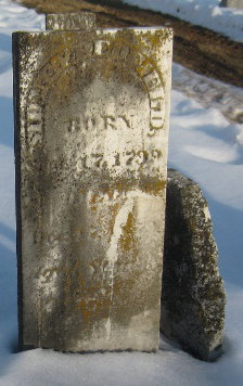
- We proceed South along the shoulder of Hwy 135 for 2.5 miles before returning to county roads for another 2 miles to the Spurgeon Hollow Trailhead. Some easements have been acquired and other are being sought to move the trail off of Hwy 135. Also there is state land from the highway over to the Spurgeon Hollow Trailhead. A provisional route of trail has been designated but not received final authorization. Near Hwy 135 off Plattsburg Lane is the historic Pioneer cemetery (photo) and Indian Wars Fort Hattabough site.