The Tecumseh Trail is approximately 49 miles.
 The KHT STARTS HERE. The TT is the northernmost section of the KHT, but it was not built first. The Knobstone Trail southernmost section is a legacy of the 1970s Environmental Movement, completed in 1981! The TT was an outgrowth of a 1996 DNR study of the possibilities for extension of the original 1970s vision of a KT. It was to stretch from Washington and Jackson Counties up through the Hoosier National Forest and Yellowwood-Morgan-Monroe State Forests.
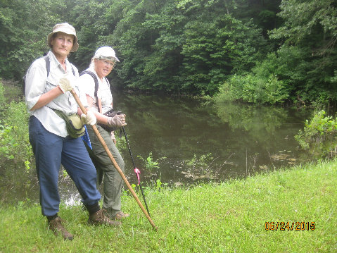
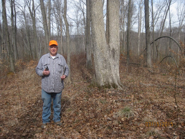 The trail was planned by MMYSF property manager Jim Allen and laid out by DNR employee Suzanne Mittenthal, who was also the founder of the Hoosier Hikers Council. It was an exciting time: 42 miles were constructed in record time, from 1997—2001, by volunteers, including many from the HHC. In 2015 an additional 7 miles were added, when Knobstone Hiking Trail Association Board president Charles Andrew (photo w. GPS) enlisted the cooperation of the Martinsville Conservation Club to provide an easement connection to MMSF land. The MCC’s priceless contribution will provide a more visible, accessible trailhead for hikers at the northern terminus [photo]. A grand 2-acre trailhead parking lot has also been donated by John W. Jones Stone, Inc., of Paragon.
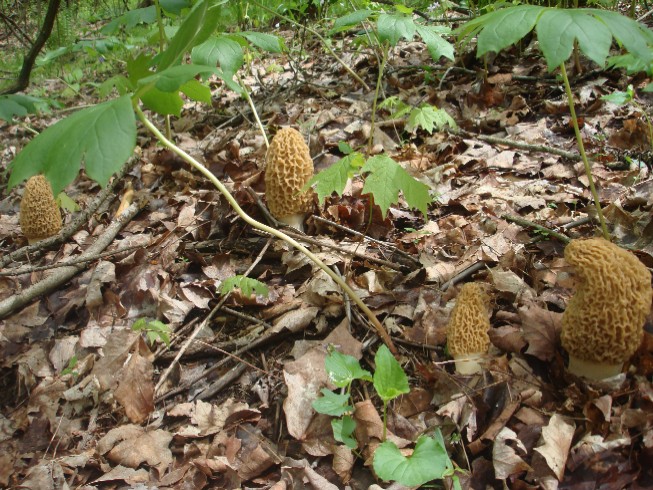 You can come from a great distance and not be disappointed in the TT’s lengthy ridge walks and meanders in its hollows (Hoosier speak for “valleys”). There are distant vistas (High King, off Scarce O’ Fat ridge, the Bluffs above Bean Blossom Creek). These acres are REMOTE for being so close to civilization (the back side of Yellowwood Lake can be as quiet as a Minnesota forest; lunch in the rock shelter will take you back in time). The mid-West’s forests are more colorful than northern forests in the fall, in late October. Spring wildflowers are enchanting anywhere; that time on the TT is early-April to mid-May. This time coincides with the emergence of the holy grail of the mushroom collector, the morel.
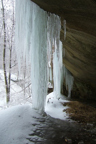 So much of Indiana is flat, hikers can be surprised by its Southern hills. Beware: limited land ownership requires sometimes siting the trail up steep slopes. Glaciers stopped far north of Florida—the TT’s contours are a result of erosion from glacial meltwaters. Hikers often “prepare” for hiking the AT’s 400-million year old eroded slopes by doing the KT. The younger KHT’s less-steep TT is good preparation for the steeper KT. However, The TT features mostly fairly long stretches of straight or curving footpaths, amenable to strolling and trail running. Obviously planted pines in some areas are a result of a different kind of erosion; these areas were denuded by improper early farming practices. Pines were planted as erosion control during the Depression when the land was deeded to the state. A few places, such as the Rock Shelter Nature Preserve (photo) just south of the MMSF HQ, were never developed.
- The Low Gap Backcountry Area was set aside in the 1970s to be an Indiana version of wilderness. The TT was looped around it, so hikers over the generations could watch it grow to meet the definition of virgin forest: a forest where its species have attained their natural mature state. It is hoped that it will continue to be managed in that way, for the hundreds of years this will take. A special feature for backpackers: camping is allowed anywhere in the Backcountry area (as well as along the length of the entire KT. This feature is envisioned for the entire TT some day.
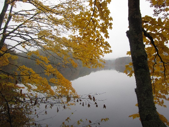 Loop trails along parts of the TT can be used to increase enjoyment of some of its sections. See the Morgan-Monroe State Forest http://www.in.gov/dnr/forestry/4817.htm and Yellowwood State Forest http://www.in.gov/dnr/forestry/4816.htm websites. Getting to know the trail by hiking sections first will give you ideas for how you want to do the whole trail. But it’s well marked; you needn’t take any precautions. [Except if it’s long and ropey looking, and has diamond patterns on its back, don’t pet the wildlife. And expect some ticks—spray and check once your clothes are off.] The central section of the TT, away from the many trails & developed campgrounds at the forest HQ/lake areas (photo), may be the wildest.
 Most hikers start in the north. A typical 3-day hike of the 42-mile TT would start at MMSF forest HQ, with overnights at the Foxes Den Shelter and the campground at the head of Yellowwood Lake. Starting from Martinsville, a 49-mile 4-day hike might include overnights in the Low Gap Backcountry in the pines along Honey Creek, a camp along the trail on the Bluff above Bean Blossom Creek/trail to Plum Creek, then the overflow campground at the head of Yellowwood Lake. You won’t believe how far from civilization you have been when you return to city life.